Thursday 31 March 2011

Grapes Hotel, Water Street

News of the £1 billion ‘Bolton Regeneration’ last weekend oddly made no mention of the Church Wharf Development which was put forward by Bolton Council as long ago as 2006. This plan, which was to develop the area of Bolton bounded by Manor Street, Folds Road and the River Croal, was put out to a ‘beauty contest’ in 2007 which was won by developers Bluemantle and Ask Developers. They proposed a £210 million “vibrant leisure zone providing restaurant and cafĂ© bar units creating a destination for diners throughout the day and evening” as well as a “5/6 screen town centre cinema” and “a 126 bedroom hotel.” Outline planning permission was granted in September 2008 but the following month Ask and Bluemantle were asking for a bailout from the taxpayer and by March of last year the two were hoping to receive up to £10 million of public funds from the North West Regional Development Agency; but this was knocked back last summer.


As this photo shows looking down Brown Street the area doesn’t look that great at the moment so it was hardly surprising the council wanted to spruce it up, though it’s a sign of late ‘noughties’ thinking that the leisure industry was being looked at to replace the largely blue-collar industries in the area.

Grapes Hotel Water Street Bolton


Diamond Glass Works occupy the old Well Street Mission building, Bolton Thai Boxing is further up Well Street and there are a few motor mechanics in the area, but have a look at the above photograph from 1937 [copyright Bolton Council]; taken from almost exactly the same spot as the photo above, there seems to be a vibrant community with shops, houses and a pub, the Grapes Hotel.

The area began to develop in the late-eighteenth century but the Grapes’ building has its own place in Bolton’s history, though from the days before its conversion into a public house. In 1818 a series of meetings were held at the premises of Robert Barlow, a wine and spirits merchant on Water Street. As a result, Bolton’s first bank – Hardcastle, Cross & Co - was set up in Mr Barlow’s premises, although by 1822 it was trading from a building in Market Street. [1]

Mr Barlow’s old premises became a beer house in the middle of the eighteenth century. It was situated on the corner of Water Street and Brown Street and in the 2011 photograph above it was roughly where the grass juts out opposite the first lamp post on the right.

Grapes Hotel Bolton


This image, from 1885 and taken from Brown Street’s junction with Manor Street shows the Grapes in the distance with Taylor’s oil and paint store where the dental repair place now is, and the Dog & Partridge next door to that.

The Grapes was a Magee’s pub when it closed in 1952 at the start of a series of clearances that turned this community almost into a forgotten wasteland. In the early seventies the construction of St Peters Way and the Folds Road car park cut off the area from Mill Hill leaving Brown Street as pretty much the only way in or out.

It’s hard to say whether the Church Wharf development is dead now that the tax payer won’t be subsidising the project. It’s all gone quiet now, and maybe that’s to the relief of the businesses that survive in the area. Maybe we shouldn’t hold our breath.

[1] Royal Bank Of Scotland Heritage Archives.

Wednesday 30 March 2011

Market Hotel (T'Crate Egg), Ashburner Street

Market Hotel Ashburner Street Bolton

The Market Hotel pictured in 1950. Image from the Bolton Library And Museums Service collection. Copyright Bolton Council.

The rather anonymous-looking wall seen on the photo at the bottom of the page  is something that thousands of Boltonians will pass everyday as they walk through the Newport Arcade on Newport Street, but it marks the spot of the Market Hotel (or T’Crate Egg, to give it its nickname) which was situated on the corner of what is now Ashburner Street and Coronation Street. It was a pub lost to the redevelopment of the west side of Newport Street in the late fifties.

This 1957 photo clearly shows Timpson’s shoe shop on Newport Street in the distance. In those days Ashburner Street was a thoroughfare that extended all the way down to Newport Street.

Although the Market was situated on the corner with Old Hall Street South no street by that name exists any more. In the 19th century Old Hall Street ran all the way from Deansgate to Great Moor Street but when the Town Hall was built in 1873 it carved the street in two. Old Hall Street North still exists; it’s the street just off Deansgate down the side of Whittakers that contains some ladies’ toilets and not much else.

The site of what was once Old Hall Street South is now Coronation Street which in those days ran parallel to Old Hall Street from the side of the Wheatsheaf Hotel to where it met Ashburner Street. When the shops on Newport Street were finally re-built in 1962, Coronation Street and Old Hall Street South were re-aligned to link together to form one continuous thoroughfare between Victoria Square and Great Moor Street.

In his book Bolton Pubs 1800-2000, Gordon Readyhough [1] reports that the Market was a beerhouse known in 1849 as the Goose With Two Necks and was later known as the Globe Vaults. It became the Market Hotel after Bolton’s wholesale market moved to Howell Croft South in 1871 and occupied the space where the Great Moor Street multi-storey car park now stands. One of the traders nearest to the pub dealt in eggs and the Market became known by the nickname ‘T’Crate Egg’ because of the habit of the trader to unload his crates of eggs by the pub door.

The pub received a full licence in 1879 when the Cross Axes on Wood Court off Deansgate (near the Old Three Crowns) closed down and licence was transferred to the Market.

When football became a professional game in the 1880s many Scottish footballers came south in search of paid football employment, but many had other jobs, often easy jobs in the mills owned by club officials but in 1886 the captain of Great Lever FC was one such Scot, Jimmy McKernan [2], a professional footballer but also making a living as landlord of the Market. The Great Lever club played on the Woodside Ground, situated on the site of what later became the Norweb offices near to Green Lane, and along with the likes of Halliwell FC and Bolton Wanderers were considered one of the major football forces in Lancashire at the time, competing in the FA Cup and supplying one player to the England team in 1883. However, with the advent of the Football League in 1888 and the Wanderers rise to pre-eminence the original Great Lever club faded away, although the name has recently been revived by a junior club.

By 1890 the Market was owned by John Atkinson & Co Ltd whose brewery stood on Commission Street in the area now covered by the new Sixth Form College. Atkinson’s sold out in 1895 to Boardman’s United Breweries of Manchester who in turn sold their breweries and pubs to another Manchester firm, Cornbrook’s in 1898 and it was as a Cornbrook pub that the Market ended its days.

The Market closed in February 1957 and prior to its demolition someone had the idea of taking photographs of the area as a record of how it looked prior to the area being redeveloped. To be honest, in these pictures the exterior of the pub was beginning to look a little bit run down but they give an idea of the Market Hotel and its immediate surroundings over 50 years ago.

A number of photos were taken of the pub in1957 but as the pub closed in February of that year some may well have been taken slightly before then.

You can see the photographs here, here, here here here here, and here.

Note the green sward of grass opposite the Market Hotel. Properties on this stretch were demolished in the late forties. The area was grassed over in 1950 and benches placed around the perimeter making a pleasant resting place for weary shoppers. By the time this aerial photo was taken in 1959
the grassed area was being used as a car park, an arrangement that lasted until the Octagon Theatre was built on the site in 1967, while the former car park in Howell Croft South was used as a bus station until buses moved to a redeveloped Moor Lane in 1969. As you can see the Market had been demolished along with all the surrounding property and work had commenced on redeveloping the area.

The wholesale market from which the pub took its final name moved from Howell Croft South to Ashburner Street in 1932, thus denying the pub some of its trade.


[1] Bolton Pubs 1800-2000, Gordon Readyhough, published by Neil Richardson (2000)

[2] Leisure In Bolton, 1750-1900, Robert Poole (1982)

Tuesday 29 March 2011

Anchor Inn, Bury Old Road

Anchor Inn Bury Old Road Bolton

The Anchor Inn, March 2011. Image copyright Lost Pubs Of Bolton.

A pub that quietly slipped off the scene in 2008 was the Anchor Inn on the corner of Eagle Street and Bury Old Road, which for the previous 25 years had operated as a free house.

Quite how long it was a pub isn’t known but the building is certainly shown on an 1848 map of Bolton. It may well have been a beer house which generally weren’t marked out on maps of the time.

According to Gordon Readyhough [1] the pub was once known as the Bright View until it became a Magee’s house and changed its name to the Anchor.

The Mill Hill area was a hive of industrial activity and there were numerous pubs between Bury Old Road and Folds Road, particularly along Mill Street and Mill Hill Street, both of which still stand. The Anchor was on the edge of the district and served a mix of industrial buildings and nearby housing in the Bury Road/Castle Street area.

After Magee’s were taken over it became a Greenall’s house and can be seen on this 1976 Bolton Evening News photograph. Note the cobbled streets and the old Bolton Parish Church school in the background (re-built nearby in Kestor Street the eighties).

Although much of the nearby heavy industry largely disappeared in the seventies and eighties there are still a number of offices and industrial units close to the Anchor. But, by the early eighties the Anchor, like a number of other pubs (e.g the Ancient Shepherd and the Alma) was surplus to Greenall’s requirements and it closed and remained empty for some time. However, it reopened in early-1983 [2] after being bought by the Mistry brothers who owned the Bantry club on Derby Street. This time it was run as a free house. Boddington’s beers were sold instead of Greenalls and there was an upturn in the pub’s fortunes. Boddies real ale was now on sale [3] at 53p for a pint of bitter, which was probably average for the time. Cask-conditioned Boddingtons Mild was soon added [4].

The Anchor was quite a pleasant pub, open-plan with a centrally-located bar on the left as you went through the Bury Old Road entrance, and a comfortable lounge ahead of you and to the right.

The pub later bought the adjoining fish and chip shop and opened it as the ‘Anchor Chippy’ serving the nearby industrial units.

The Anchor quietly closed in 2008 and is now known as the Anchor House. The Mistrys have got out of the licensed trade altogether and the old pub is now being run as office premises. Indian Karaoke is one of the businesses based there while the former chippy is now Mandy’s Pantry.

[1] The Pubs Of Bolton 1800-2000, Gordon Readyhough, published by Neil Richardson (2000)
[2] What’s Doing, the Greater Manchester beer drinkers monthly magazine, March 1983
[3] What’s Doing, May 1983
[4] What’s Doing, October 1983

Anchor Inn Bury Old Road Bolton


A side view of the Anchor Inn in 2011 taken from Eagle Street and showing the anchor stone near to the top of the building.

Image copyright Lost Pubs Of Bolton.

Monday 28 March 2011

Prince Rupert, Holmeswood Road

Prince Rupert Holmeswood Road Bolton

The Prince Rupert pictured in March 2011. Image copyright, Lost Pubs Of Bolton, 2011.

Lever Edge Lane was a small country lane that appears on maps in the mid-nineteenth century and probably existed before that. At the end of the 18th-century it is shown running all the way down to Manchester Road from Morris Green before part of it was named Green Lane (originally George Green Lane) during the 19th century.

Like most of the south side of Bolton, there were a number of mine workings in the area in the 19th century, with Lever Edge Colliery situated no more than about 100 yards away to the south of where the Prince Rupert was eventually built.

By the mid-thirties a row of terraced houses ran down one side of Lever Edge Lane from the Morris Green Lane end, but beyond that there were few houses other than the top of a row that ran back down Higher Swan Lane and Auberson Road, although the area towards Rishton Lane was a little more heavily populated.

The area between Morris Green Lane and Great Lever began to be populated from the 1930s onwards. By 1936 more houses were being built along Lever Edge Lane, effectively joining up developments at each end of the mile-long lane. A number of pre-fabricated houses were built on part of Lever Edge Lane and in the fifties the area to the south of the lane was heavily developed with the construction of the Orlit estate, and then Hayward Schools (now the Essa Academy).

Walker's brewery secured a plot for a new pub on Holmeswood Road which, although set back from what is now Lever Edge Lane, was part of the original trajectory of the road as this map shows. Walker's built and completed the pub in 1960 and named it the Prince Rupert. Although obtaining a licence to sell just beer was a little easier, all new pubs were obtaining full licences which meant they were able to sell wines and spirits as well. These were more difficult to obtain unless an existing licence was transferred from another pub. As a result the Prince Rupert obtained its licence from the Roebuck Hotel on Kay Street, which closed as the Prince Rupert opened.

The name itself probably came from a farm which stood in the area and which was named Prince Rupert Farm, although it appears as Lever Edge Farm on some maps. The farm stood next to where the pub was built on the site where Windsor Court now stands., although it was demolished in 1949 before the whole area was redeveloped.

Given Prince Rupert of the Rhine's part in the Storming of Bolton in 1644 in which at least 1000 Boltonians were massacred, it's hard to see why he should be commemorated in the naming of a farm, then a pub and also a street (the nearby Rupert Street). It's possible that detachments of Rupert's 3,000 men were camped in the Lever Edge area, though it is commonly held that they were camped on the site of the current Cannon Street, about a mile away. Although given that 3,000 men take up some considerable space it is entirely likely that on the night before the Storming of Bolton they were all over the moors to the south of the town. However, it is believed that the night before the storming, Prince Rupert lodged at the farm which subsequently took his name. [1]

The Rupert was a typical estate pub and, to be fair, it wasn't that bad for much of its existence. Architecturally, it was very much of its time and quite similar in some regards to the Morris Dancers, which was built the following year. Bizarrely, after previously being pub-free the Morris Green/Lever Edge area found itself with two new pubs opening in the space of 12 months.

A vestibule at the front offered access to toilets with a games room to the left and a smart lounge to the right. As there were no off-licences in the area at the time the pub was built there was also a room with a separate entrance that acted as the pub's 'off-sales' section. (Yates's Wine Lodge in town had something similar until a refurbishment in the early eighties). The pub was serviced by one long bar covering the lounge, the games room and the off-sales area.

Beer-wise the pub was typical of estate pubs in that it offered only keg beer – Double Diamond (remember that?) was the keg brand of Tetley's, who took Walker's shortly after the Prince Rupert opened. Not that real ale didn’t make an appearance – there were some enterprising landlords who gave it a go – I seem to remember Walkers Bitter appearing on hand pumps, it just didn't last long.

In effect this was a typical locals' pub, the centre of the community, with football teams and a number of ladies rounders teams based at the pub, but just as many estate communities have fallen on hard times, then so did the Prince Rupert. Towards the end it endured at least one period of closure in between licensees and despite the best efforts of some of those who took over the pub – leaflet drops, karaoke nights, discos – it fell a victim to changing social norms, cheap supermarket booze and the smoking ban. The final licensee saw out Christmas 2008 and a couple of days into 2009 the Prince Rupert closed its doors for the last time.

The pub was put up for sale but the chances of it ever re-opening as a pub again must be close to zero. In the two years since it closed it has been broken into on a number of occasions and the lead has apparently been stripped from the roof. It will be a surprise if the property is used again for any purpose, which is sad.

UPDATE: 28 March 2014. The Prince Rupert was bought for use as an Islamic education centre and opened as such in 2013 after a refurbishment.

[1] St Michael's Parish Church centenary pamphlet. 1951.

Prince Rupert Holmeswood Road Bolton

The Prince Rupert pictured in March 2011, two years after its closure. The small extension on the left-hand side was originally the off-sales counter with a separate entrance from the rest of the pub.

Image copyright, Lost Pubs Of Bolton, 2011.

Roundcroft Tavern, James Street


The University of Bolton as seen from the Derby  Street end of what was once Fletcher Street but which is now Edgar Street, 26 March 2011. James Street was directly across the main road and ran down to Deane Road.

Image copyright 2011 Lost Pubs of Bolton.

When it was decided to build the Bolton Institute Of Technology (now the University Of Bolton) on a site bounded by Deane Road, Derby Street and John Street it meant the end for a small community of houses, shops and factories that stood in Kirk Street – which was badly damaged in a Zeppelin bombing raid on Bolton in 1916 – Ebenezer Street, James Street, Roundcroft Street, Bethel Street, Liptrot Street and Ardwick Street. All were demolished in 1965 so the BIT could be built and the redevelopment also saw a number of pubs demolished. These were mainly on Deane Road and Derby Street but there was one, the Roundcroft Tavern, that stood off both main roads at number 50 James Street.

The Roundcroft was a beerhouse that brewed its own beer in the late nineteenth century but was a Wilson’s pub by the time it was granted a full licence in 1962. At the beginning of 1965 the Roundcroft closed and it was demolished at the end of January that year along with the Britannia, the Milestone and the Gladstone, all of which fronted Deane Road. The BIT began to move into the Deane Campus when the first phase was completed in 1967 but someone at the college had the foresight to capture the whole area for posterity both prior to and during the demolition process. The Roundcroft is shown rather forlornly here on 18 January 1965. The pub’s signage has already been removed while the neighbouring houses have been gutted ready for the bulldozers. Another photo,from May 1964, shows the area to the rear of the pub which was clearly still occupied while the front is pictured here. The regulars undertook their final annual outing on the thirtieth of that month.

Other photos from the mid-sixties of the area now occupied by the University Of Bolton are shown here, here, here, here, and here.

James Street ran from Derby Street to Deane Road and began just opposite where the bedroom furniture shop stands on the corner of Edgar Street and Derby Street (until 1980 it was Fletcher Street until that road was re-routed to end at the traffic lights outside what is now McDonalds). The Roundcroft was situated about a third of the way down from Derby Street just past a ‘dog-leg’ bend in the road.

At the end of the nineteenth century the pub’s landlord was George Hilton who would often sing to the customers as he served them their drinks, a novel approach to customer service. George’s seven-year-old son Jack would also sing at the pub. Billed as 'The Singing Mill Boy' he would accompany his father on popular songs of the day such as Thora, and A Miner’s Dream Of Home.

This was young Jack’s first public performance and it obviously gave him a hunger for more. Later, he slightly altered the spelling of his surname and became a notable band leader under the name of Jack Hylton touring America and Europe with his own band until the early days of the Second World War. He later went on to become a director and major shareholder in Decca Records.

Here’s a video of Jack and his orchestra with their 1931 hit Choo Choo.


This picture shows the student union bar being built around 1970. Next to the bar was the refectory which was also used by the Students Union for live music performances in the seventies when it hosted such acts as Hawkwind, Joy Division, Motorhead, The Fall and The Scorpions.

It would be nice to be able to say that the likes of Lemmy and Mark E Smith performed in the exact spot as George Hilton and 'The Singing Mill Boy' but it would be a lie. As this map shows, the Roundcroft was actually situated a few yards away.

Incidentally, the Bolton.org.uk website consists of a ‘virtual walk’ around Bolton. The site was developed during the nineties at the then BIT and although the photos on the site are ‘only’ 15-20 years old they are themselves rapidly becoming a testament to a town that, for better or for worse, is constantly changing.


The University of Bolton pictured in March 2011. The Roundcroft Tavern was situated just to the right of the white building in the middle of the picture. Although the university buildings have been considerably altered at the Deane Campus in recent years, gigs at was then the BIT took place in the cream building to the left of the picture.


Saturday 26 March 2011

Spinners Arms Brownlow Way


Image copyright, Google Street View.

Spinners Arms Brownlow Way 2009


The Learners Arms and World Cafe, formerly the Spinners Arms in 2009. The building was more recently (2015) the Mojo Trust.

When The Spinners on Brownlow Way was completed in 1974 it was effectively a replacement for a number of pubs that had been swept away in slum clearances that saw row upon row of terraced houses demolished and new social housing built in their place.

For those who wanted the pub stock to fall the clearances brought a huge result. Over a dozen pubs in the area bounded by what is now Prince Street/Merehall Drive, the south side of Halliwell Road, and Higher Bridge Street were swept away with just two as the Cotton Tree and the Spinners Arms were built in their place. The whole landscape between Halliwell Road and Chorley Old Road was altered for ever but the area’s pubs were hardly adequately replaced.

Pubs such as the Swiss Hotel, the Queens Hotel, the Mount Street Inn, the Woodman and another pub named the Spinners Arms all stood within 100 yards of Brownlow Way, a thoroughfare which was itself carved out of this urban redevelopment as part of the need to easily link two of the main arteries heading out of the north-west side of the town.

But what the residents got instead was The Spinners Arms, a small, modern pub on the edge of the shopping precinct and right next to St Matthew’s church.

But look at it from another angle: how must the first set of locals have felt when they moved into the new estate and found a comfortable pub with soft furnishings, soft orange lighting and a lounge that looked out over a panoramic view of Halliwell’s ‘New Jerusalem’ and with the lights of the east side of Bolton twinkling in the distance. That isn’t a sarcastic comment. After a warm, dry house with a small patch out of grass out the front replacing damp Victorian terraces with outside loos, and (relatively) clean tarmac-laid streets instead of the cobbled setts the Spinners must have seemed like the icing on the cake, the tin hat, the final realisation that the long days of post-war austerity were finally behind them. Instead of beers from Magee’s and Walker’s they could drink a pint of keg Red Barrel that tasted the same every time and would never go off and was another facet of this modern world they suddenly found themselves in. Or they could head into the games room to the left of the entry for a game of darts or American pool.

So where did it all go wrong? Well, at the end of the day these estates almost became like the ‘new slums’ and when The Spinners finally closed in the first decade of the 21st century, like so many pubs it had gone from being owned by a business – Wilson’s Brewery – who brewed the beer and owned the pubs, to a property company who simply saw that the punters weren’t coming in, couldn’t find a tenant or a lessee to take it on and who finally gave up the ghost. By that time the whole of the immediate area was an eyesore. People had not only forsaken the pub but also the shopping precinct at the back of it with rows of empty shopping units a testament to the fact that what had replaced those rows of terraced houses in cobbled streets hadn’t necessarily been an unmitigated success.

The old church was knocked down and rebuilt a few yards away while the precinct was demolished a few years ago and replaced by more housing. The Spinners is now a community centre known as the Learners Arms and World Café and is probably fulfilling just as much of a social function these days that it did as a pub. The other new pub development of that time, the Cotton Tree, still survives but 200 yards away in the other direction the City Hotel is now a pile of rubble, such is the fate of many estate pubs these days.

Friday 25 March 2011

Spread Eagle, Hulme Street


Image copyright Google Street View

We’re just over a week late in commemorating the 30th anniversary of the demise of this pub, but better late than never.

Readers of this blog will have to become accustomed to photographs of patches of grass where pubs once stood, but the fact is that once demolished the sites of many pubs remain empty for years, sometimes permanently. The site in this photograph is one such example. It’s a pleasant patch of grass lined by trees at the junction of Lark Street (known as Lever Street on the 1849 map of Bolton) and what was once Hulme Street but which is now a continuation of Charles Street, but this patch of land is the site of the Spread Eagle Hotel.

The Spread Eagle was a large multi-roomed street-corner pub, one of many in an old residential area of the town. Two flights of steps led from the street up to the main entrance where the lounge led off to the left and the vault to the right. The pub always served a good selection of Tetley real ales, Mild and Bitter.

Opened in 1843 it became a Sharman’s pub before passing to Tetley Walker in 1961, via Sharman’s takeover by George Shaw of Leigh in 1921 and Shaw’s takeover by Walker, Cain Ltd of Warrington in 1927. [1]

The Spread Eagle was tucked away in the side streets off Folds Road and at one time it served a vibrant local community but the pub gradually became isolated after the housing clearances of the sixties and seventies although it was frequented by students from the nearby annexe of Bolton Technical College; but by the end it stood alone, set back and practically invisible from Folds Road, the houses that once formed the bulk of its custom long gone.

In the nineteenth century the area was a hive of activity and other long-lost pubs such as the British Oak, the Hulme Street Tavern, the Premier Arms, the Standard Arms, the Middleton Arms and the Union Arms all stood within about 100 yards of the Spread Eagle. That a teetotal working men’s club in the area lasted only a few years  during the 1860s should come as no surprise.

The area also seems to have been a hotbed of Chartism in the 1840s. Of the 800 Bolton subscribers to the Chartist land company share register, 18 were from addresses in the Hulme Street/Charles Street area.  Subscribers were hoping to be allocated land on one of the colonies of smallholdings established by the Chartist movement to re-house industrial workers. In turn this would give them the vote and other democratic rights that we now take for granted.

One-by-one the pubs near the Spread Eagle began to close although the bulk of those mentioned closed   in the early part of the 20th century. The end for the Spread Eagle came on 16 March 1981 [2] when it closed its doors for the final time. The pub lay empty for a few years before finally being demolished.

Ironically,  new housing developments have since sprung up in the area meaning that Hulme Street, Charles Street and Lark Street now host a residential community once more. Sad to say, all that came far too late for the Spread Eagle. The site of the pub was never built on and is now a landscaped area directly in front of some new houses.

Spread Eagle Hulme Street Bolton
Spread Eagle in about 1974


[1] Bolton Pubs 1800-2000, Gordon Readyhough, published by Neil Richardson (2000)
[2] What’s Doing, the Greater Manchester Beer Drinkers  monthly magazine, April 1981

Thursday 24 March 2011

George Hotel, Great Moor Street


Refurbishment work begins at the former George Hotel, Thursday 25 March 2011.


Builders got to work on the George Hotel in March 2011, but rather than it being replaced with a 12-story block of flats as had been thought, it was eventually converted into student flats. With that the pub’s long, drawn-out demise is finally to be brought to its inevitable sorry conclusion.

The George hadn’t operated as a pub since around 2000 and all efforts to sell it as licensed premises have failed. In the end the property was sold for just £50,000 and despite calls to retain the frontage the whole lot will be a pile of rubble in due course.

What a shame as it was a decent pub, one I went in many times without it ever appearing to be so busy. I used to go in there in the eighties and early nineties and I don’t think I ever saw more than 20 people in what was a decent-sized pub.

Like many Wilson’s pubs of that time it sold real ale from electric pumps and to be fair it always sold a decent pint and at a reasonable price. A survey in 1986 showed that the Geroge had the cheapest real ale in the town centre with a pint of Wilson's Mild costing just 67p while Wilsons Bitter was 71p a pint. [1] though the Mild was taken off due to poor sales just a few months later. [2]

The last time I went in there, around 1999, real ale had long gone in favour of smooth John Smiths Bitter. Custom was as thin on the ground as ever and sure enough it had closed within a year.

The layout of the George hadn’t changed since I first went there. The pub had two entrances: one on Blackhorse Street that gave access to the lounge, and one on Great Moor Street that led to the vault on the right. In later years another entry on the corner of Great Moor Street and Blackhorse was re-opened to provide direct access to the vault.

Given the not inconsiderable size of the pub the lounge only had a moderate number of seats, not that its capacity was regularly tested. There was more seating in the vault while two rooms to the side of the pub were used as meeting rooms by local societies.

The George dated back to the 1820s and was at one time known as the George Inn and Railway Hotel as a nod to Bolton’s first railway station at Great Moor Street which opened just across the road in April 1831, almost three years after the completion of the Bolton to Leigh railway line, the second oldest in the world.

The immediate area was particularly squalid, as this report into sanitation in the town described in the middle of the 19th century:

“Behind George Inn there are five [privies] placed in a row, most of them without doors, and the passage past them is used as a thoroughfare, from one street to the other.” [3] So the loo was a toilet without a door at the side of the street! This would probably have been at the junction of Stable Row and Back Weston Street. Stable Row ran from behind the George and across the railway line via a narrow bridge to New Street which is where the back of the market is.

Confusingly to the modern reader, that part of of Great Moor Street beyond Blackhorse Street was known as Weston Street some years before another thoroughfare of that name was constructed to link Manchester Road and Rishton Lane.

In September 1851 the street outside the George was the scene of a rescue operation after 14-year-old John Hutton became stuck in a sewer. In what to us might seem like a remarkable act of procurement, the council had engaged a local collier to clean the sewer and the collier had entrusted young Hutton and another youth to do the job. The lads went into the sewer on the Saturday morning but by 5pm Hutton had become stuck. Excavations took place but were halted later that evening after it became dark. When Hutton’s body was recovered at eleven o’clock the following morning it was discovered he had been dead for only an hour. The council later rewarded many of those who took part in the rescue. [4]

The George became a Wilson’s house in 1949 following their takeover of Salford brewer Walker and Homfrays. At the end of the 19th century the pub was owned by the Manchester Brewery Company who were subsequently taken over by Walker and Homfrays. No doubt the closure in 1954 of Great Moor Street station affected passing trade although you might have thought that the construction of Hargreaves House a few years later would have given the George some local business.

In the 1998 update of his book Bolton Town Centre: A Modern History covering the Great Moor Street area, Gordon Readyhough pointed out that in the 1930s Great Moor Street boasted nine hostelries but “in 1998 only the George, the Griffin and the Railway remain.” [5] No longer – only the Griffin is still a pub.

George Hotel Bolton


The George, pictured on the right of this 1962 image of Great Moor Street. Image from the Bolton Library and Museums Service collection. Copyright Bolton Council.

[1] Bolton Beer Break, Summer 86
[2] What’s Doing, September 86
[3] A Report Of The Sanatory Condition Of The Borough Of Bolton, John Entwisle, 1848.
[4] Annals Of Bolton, James Clegg, 1888
[5] Bolton Town Centre: A Modern History. Part Two: Bradshawgate, Great Moor Street and Newport Street, 1900-1998. Gordon Readyhough, published by Neil Richardson.


Image copyright Google Street View.

Wednesday 23 March 2011

Sunnyside Hotel, Adelaide Street


Image Copyright. Google Street Maps.

The area around Daubhill was a quiet rural area in the middle of the 19th century, but as Bolton’s cotton industry expanded the town centre was no longer large enough to cope and entrepreneurs began to build their mills outside the centre. The south side of Bolton was an area of moorland which had been enclosed by Act of Parliament in 1792 and although there were weavers cottages, mining and brick making were the main industry with the area dotted with coal mines and clay pits.

When the new mills arrived they were soon followed by houses and with the houses came the need for pubs to quench the thirst of the working classes.

In 1853 Henry Lee was a partner in the local firm of Tootal, Broadhurst and Lee, a small manufacturer of muslins based close the town centre in Stanley Street, which ran until recently from the bottom end of Deane Road down towards the railway line. The new sixth-form college was recently built on the site.

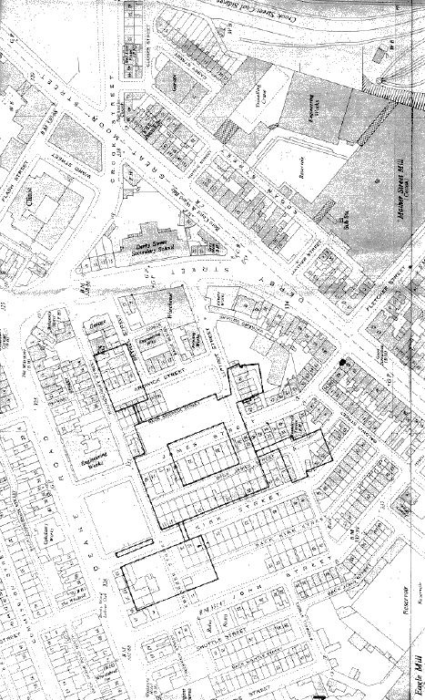
In 1860 Lee bought a small weaving mill and engine house in Daubhill and from 1862 to 1867 Tootal, Broadhurst and Lee built the imposing Sunnyside Mills on land bounded by the Bolton and Leigh railway line, Adelaide Street and Crowshaw Lane (later re-named Ellesmere Road). The railway route to the town centre was re-routed in the 1880s although the sidings linking Sunnyside mills remained in use until 1969.

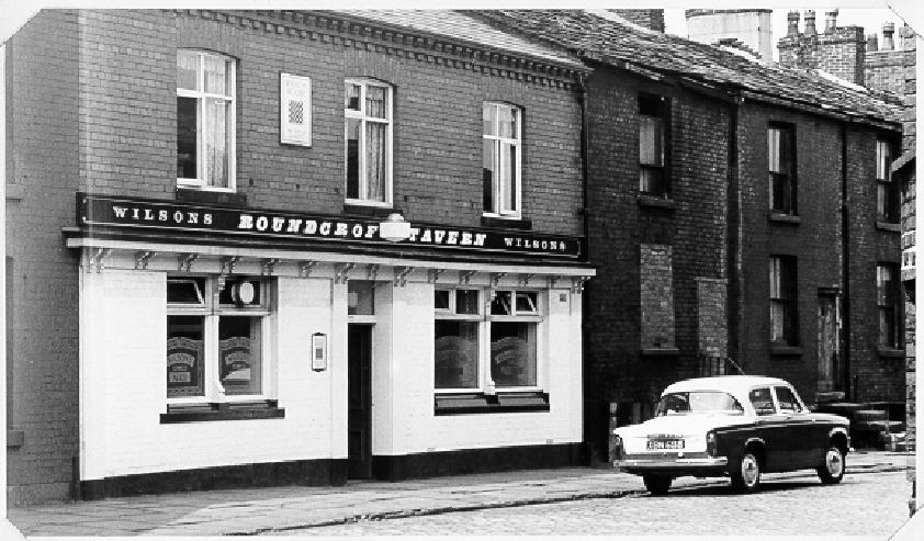
Streets of terraced houses were then built in the area of the old line – streets such as Auburn Street, Essendon Street, and a whole host of streets with girl’s names – were all built from the 1880s onwards and about that time the Sunnyside Hotel was built to serve both the mills’ workforce and the new residential neighbourhood, although to be truthful the two were most likely one and the same.

The Sunnyside was originally a beer house called the Rising Sun. It began in the 1860s by a gentleman named Henry Yates. Henry was originally a coal miner who worked in the coal field around Middle Hulton and Little Hulton. In 1851 he was living with his family at Bates Houses, which still stand on Salford Road, the A6 heading towards Little Hulton.

By 1861, Henry had taken a familiar route out of the coal mine and was the owner of a beerhouse in Little Hulton, but he moved a couple of miles up the road to where Tootal, Broadhurst and Lee were building their new mills and he began to rent a small cottage at number 1 Crowshaw Lane (now known as Ellesmere Road).

Ten years on, the 41-year-old Henry, his wife Ellen, and their four children aged from 1 to 14 years old at the premises that were now at 1 Bloom Street, which was actually the street that ran along the side of the pub.

It was around this time that Henry added some nearby farmland to his business interests. The 1881 Census shows him as a beerseller and a farmer with some 5 acres of land.

Henry sold out before the end of the nineteenth century to Sharman’s brewery based near Mere Hall on the other side of town. He retired to one of the newly-built houses further up Ellesmere Road although he was still farming his five acres at the age of 71. He ended his days living with his grandson, Henry Hulme, Henry’s wife Dora and their young son, also named Henry (three Henrys in the same house!). Henry Yates died in 1913 at the age of 83.


Sharman’s rebuilt - and renamed - the Sunnyside in 1900 and in 1906 they obtained the full licence given up by the Ship Inn on Bradshawgate which was demolished when that thoroughfare was widened.

The Sunnyside was famous for its bowling green which was installed when the pub was rebuilt and which staged matches between the leading bowlers of the day. Right up to the seventies the results of those matches were of sufficient importance to make the northern editions of the following day’s national newspapers.

However, the fate of the pub was largely linked to that of the nearby mills and in 1980 Tootal’s – by this time part of the Coats Viyella group - closed Sunnyside Mills at the height of a recession. By then the pub was owned by Tetley’s who mulled over the its fate before it became an Irish centre around 1981.

In 1985 the Sunnyside was sold to David Rowlinson and became a real ale free house but despite the attraction of live bands in the lounge and exotic brews from some of the country’s independent brewers the pub was unable to pay its way and it closed at the end of 1985. [1] It was subsequently damaged by a fire that destroyed much of its interior.

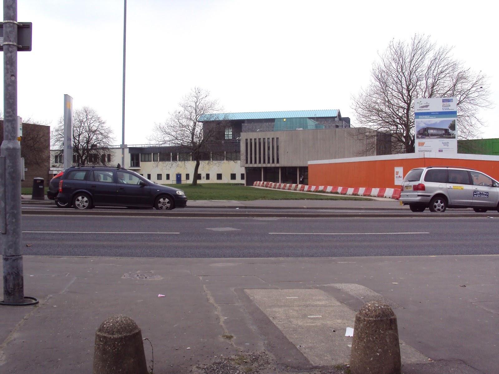
After being viewed at by Boddington’s, Banks’s and Holt’s [2] the Sunnyside was bought by Harry Byrne in 1986. Harry spent £20,000 on a refurbishment, installing a children’s playground and beer garden to the rear and in May 1986 it re-opened with a late licence that enabled the Sunnyside to open until 1.30 at the weekends. [3] But despite an upturn in fortunes the Sunnyside closed as a pub in September 1988 after Harry received an offer for the premises from a nursing home operator. The pub was refurbished once again, this time as a home for the elderly which it remains as to this day. Housing now surrounds the Sunnyside as the former Townson’s works to the rear was re-developed in 1990-91. The famous bowling green has been sold off in recent years and a residential property has slowly – very slowly – been built on the site.

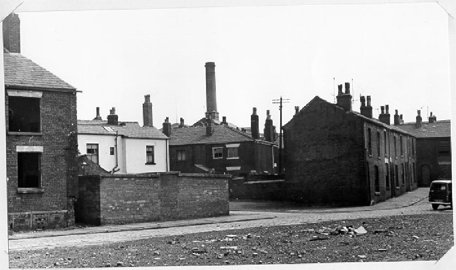
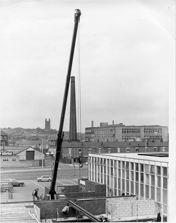
Sunnyside Mills were demolished soon after they closed although parts remain visible to this day as this picture shows.

Tootal’s laid out extensive leisure facilities for its employees on a site between Ellesmere Road and Higher Swan Lane. Tennis, cricket bowling, a miniature golf course and putting green were all available along with a fine pavilion. These were turned over to Bolton council many years ago; the cricket field was used for many years by Bolton YMCA but has been used since 1986 by Manchester Association side Deane & Derby CC. The rest of the amenities form part of Sunnyside Park, and is still a much-used local amenity.

[1] What’s Doing, December 1988.
[2] What’s Doing, July 1986
[3] What’s Doing, June 1986


* Article updated 9 February 2015 with details of the Rising Sun.


A side view of the former Sunnyside pub in March 2011. The house to the right is being built on the site of the pub's famous bowling green and had been undergoing construction for around two years when the photo was taken.